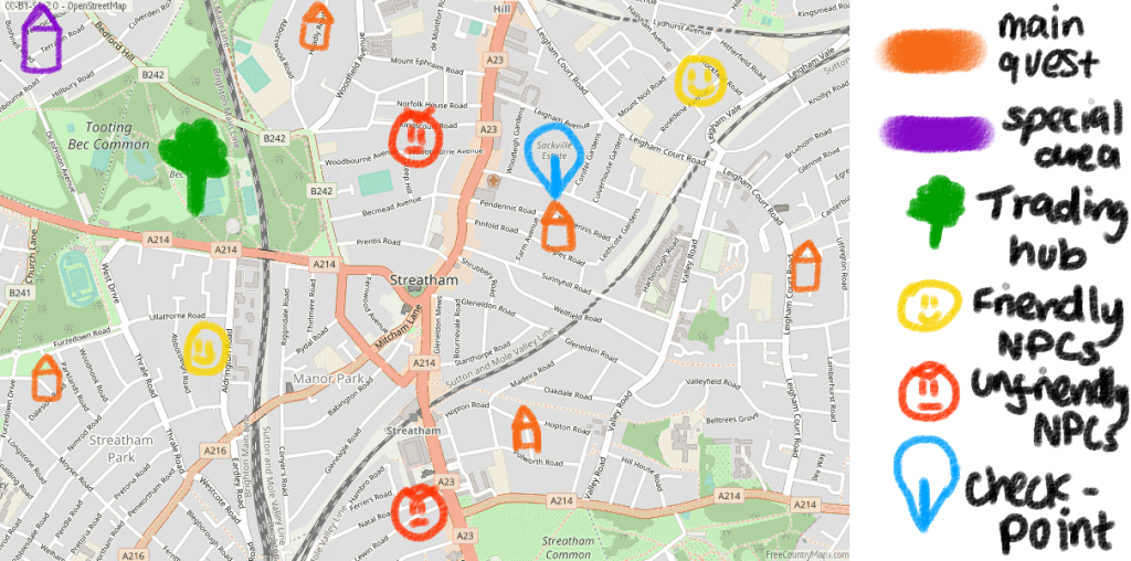
Due to an inability to envision a Map (and envision things in general, thank you aphantasia), I’ve sketched what the town map would look like vaguely on top of an already existing town map. You might see that this is similar to many RPG games with the symbols meaning different things like friends/foes/neutral or important landmarks. I was inspired by open-world games like Balder’s Gate 3 and GTA 5 which treat maps like a real-life map. In a complete world of this game, Rattham would have its streets with their names and landmarks.
The map would serve as a guide for places you need to go to, optional places, markers for areas/territories you are welcome in (and are also not), and once you find the entrance, the “portals” to the inner city.
I’ve used Streatham as a reference, as it’s a neighbouring area I’m quite familiar with that has a balance of greenery and parks with urban infrastructure. Therefore, I think it’s the perfect candidate to base on my ideas of a Rattham map. Indeed, Rattham is based quite a bit on Streatham and several other urban and suburban parts of London. For a final version of the game, I do want Rattham to be set apart from real-life territories and have its history and drama. If I had more time, I’d definitely research the history of how towns are formed and what gives a town its identity.
Simulated Exploration Scene
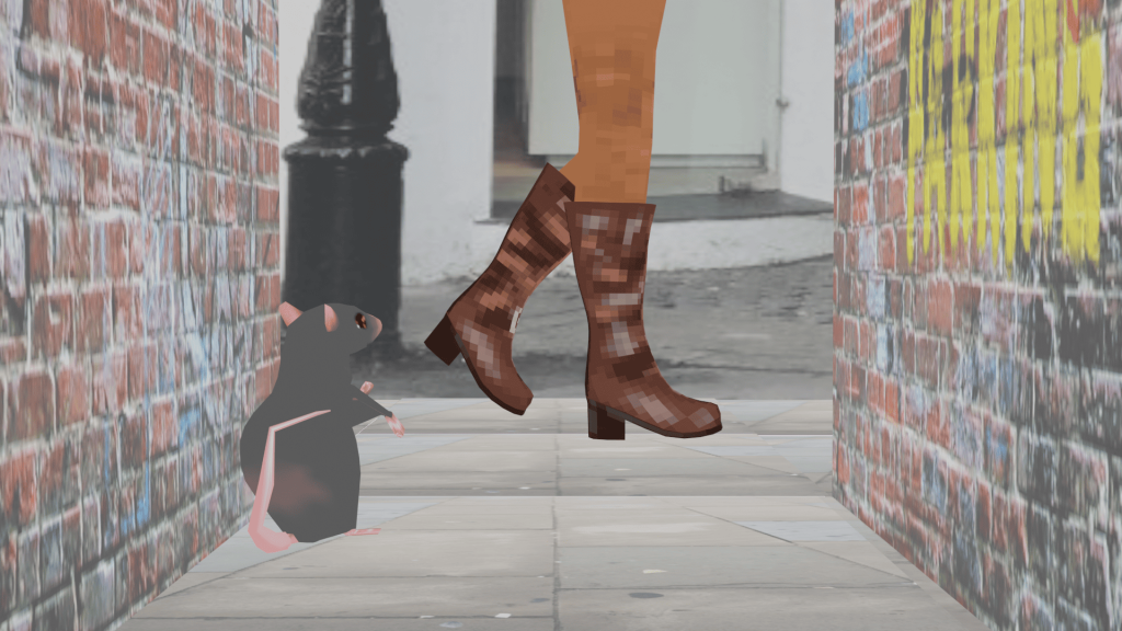
The process of this scene can be found here.
Your Rat player character can explore places such as alleyways, sidewalks, small cracks; anywhere that a normal Rat can scurry their way into. I made a simulated exploration scene using the two models I made to show the camera view and what the player would be seeing.